'Pokémon Go' players unknowingly trained delivery robots with 30B images
Source: Hacker News
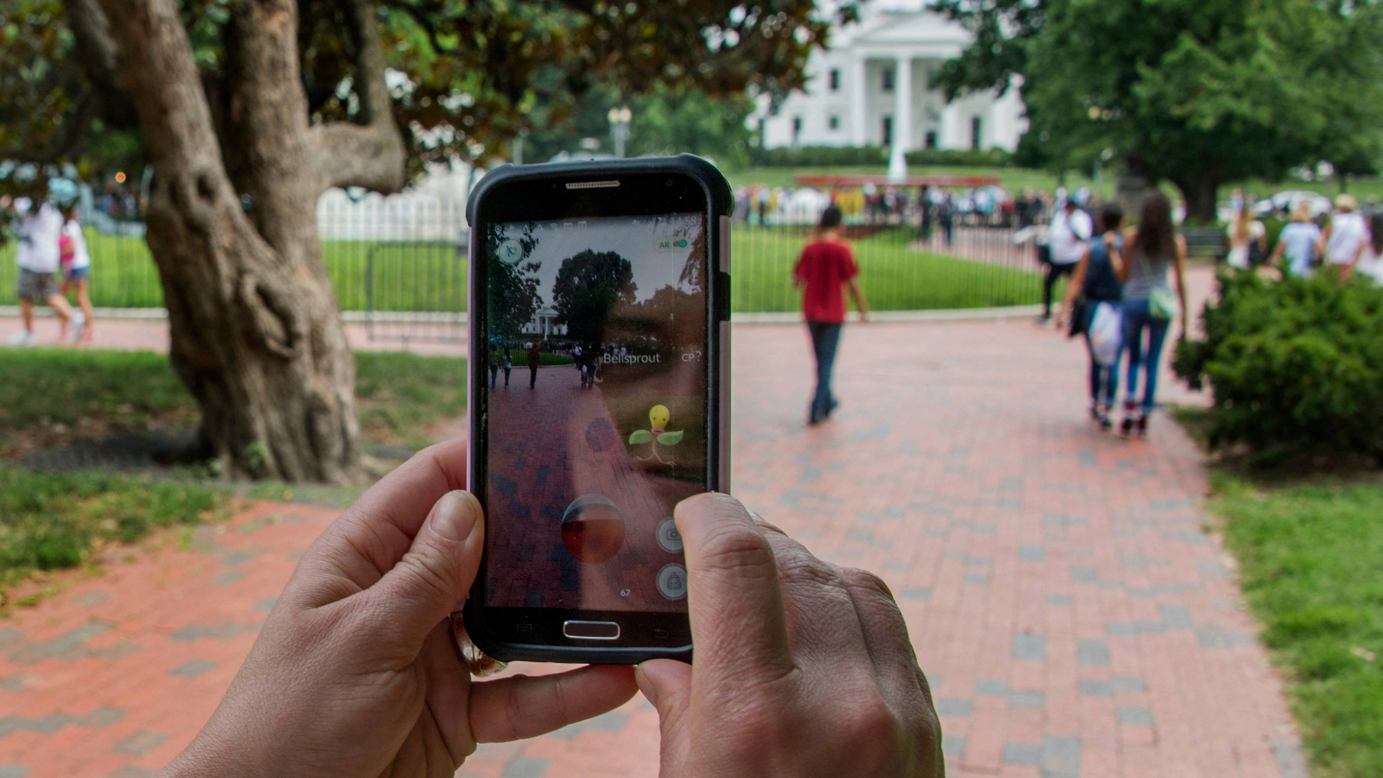
Photo: Jim Watson/AFP via Getty Images
Overview
Nearly a decade ago, Pokémon Go turned the real world into a digital scavenger hunt, with virtual creatures hiding in plain sight. The early augmented reality smartphone app prompted hundreds of millions of players to wander into parks, parking lots, and even dimly lit alleyways, peering through their phone cameras in search of Pikachus and Charizards that the app superimposed onto their surroundings. It was a major hit (Time).
But ten years on from the app’s peak, that same crowdsourced data may now help the piping‑hot pizza you ordered find you.
This week, Niantic Spatial—the team behind Pokémon Go—announced a partnership with Coco Robotics, a company that makes short‑distance delivery robots for food and groceries. Soon, those robot couriers will scoot around sidewalks using Niantic’s Visual Positioning System (VPS)—a navigation tool that can reportedly pinpoint location down to a few centimeters just by looking at nearby buildings and landmarks. Niantic trained the VPS model on more than 30 billion images captured by Pokémon Go users, and claims it will help robots operate in areas where GPS falls short.
In other words, all that time users spent wandering around playing Pokémon Go will now help determine how well a courier robot can deliver your take‑out. It’s a stark example of how crowdsourced data, seemingly collected for one purpose, can be quietly repurposed years later for something quite different.
“It turns out that getting Pikachu to realistically run around and getting Coco’s robot to safely and accurately move through the world is actually the same problem,”
— Niantic Spatial CEO John Hanke, in a recent interview with MIT Technology Review (link).
How Niantic Repackages Pokémon Go Data
Instead of helping users navigate the way that GPS does, VPS determines where someone is based on their surroundings. That makes Pokémon Go particularly useful as a data source, because players had to physically travel to specific locations and point their phones at various angles.
The mapping effort got a significant boost in 2020, when the app added what it called Field Research – a feature prompting players to scan real‑world statues and landmarks with their cameras in exchange for in‑game rewards. A portion of the data also reportedly came from areas known as “Pokémon battle arenas.”
Whether players knew it or not, those scans were creating 3‑D models of the real world that would eventually power the Niantic model. More data means better accuracy, and because Niantic was collecting images of the same locations from many different users, it could capture the same spots across varying weather conditions, lighting, angles, and heights.
There’s no shortage of raw material to draw from either. At its peak in 2016, Pokémon Go had ≈ 230 million monthly active players【1】. Though less culturally relevant in 2026【2】, the game still hovers around ≈ 50 million active users【3】.
Related Stories
(Insert related story links or summaries here)
References
- Business of Apps – Pokémon Go statistics.
- Popular Science – “Pokémon Go lost a third of its users.”
- Active Player – Pokémon Go active user estimates.
How Pokémon Go Data Could Help Robots Find Their Way
Niantic and Coco are betting that Pokémon Go data will help delivery robots understand precisely where they are simply by looking at landmarks around them. Most autonomous robots currently use some form of GPS for navigation, but it isn’t always reliable — see the Facebook video on GPS issues.
Delivery robots tested on college campuses have been known to get lost or struggle to cross streets — read the CBS News report. That confusion can lead to delays, and—as any diner who has waited too long for a hot meal can attest—timely delivery is crucial. After all, time is money.
“The promise of last‑mile robotics is immense, but the reality of navigating chaotic city streets is one of the hardest engineering challenges,” said Hanke in a statement.
While spotty GPS is often associated with state parks or remote rural areas, signal reliability is also compromised in dense urban canyons. Tall, closely‑spaced buildings interfere with signals, causing the location dot on a map to drift. Coco’s robots plan to use VPS (Visual Positioning System) and four cameras mounted around the machine to obtain a far more precise read on their surroundings, helping them deliver food on time.

VPS uses four cameras to get a more precise reading of its surroundings.
Data Repurposing: From Games to Real‑World Applications
This isn’t the first time data freely scavenged by internet users for one purpose ends up powering something else entirely.
| Original Use | How It Was Repurposed |
|---|---|
| Google’s CAPTCHA tests (clicking bicycles, traffic lights, etc.) | Speculated to train AI vision models — see the PopSci article and a Medium post on the topic. |
| User‑generated content from Waze | Allegedly accessed or purchased by law‑enforcement for investigations — see the 9to5Mac report. |
| Niantic’s VPS data (potentially) | Could be attractive to police because it can pinpoint locations from photographs — read the analysis on 404 Media. |
Niantic has not suggested any plans to provide its VPS data to authorities, but the capability to accurately locate a spot based on visual landmarks is undeniably powerful.
Building a “Living Map”
Niantic says its partnership with Coco Robotics is part of a longer‑term effort to build a “living map” of the world that updates as new data becomes available. Once VPS‑equipped delivery robots hit the streets, they will collect even more information that can be fed back into the model, further boosting its accuracy.
This continuous, real‑world data collection mirrors the approach used by self‑driving vehicle companies such as Waymo and Tesla—the same strategy that has driven rapid improvements in autonomous‑driving technology over recent years.
So, the next time you see someone in a park trying to “catch ’em all,” remember that the data gleaned from that scavenger hunt could play a key role in getting the pizzas of the future to your doorstep on time.

2025 PopSci “Best of What’s New” – The 50 most important innovations of the year